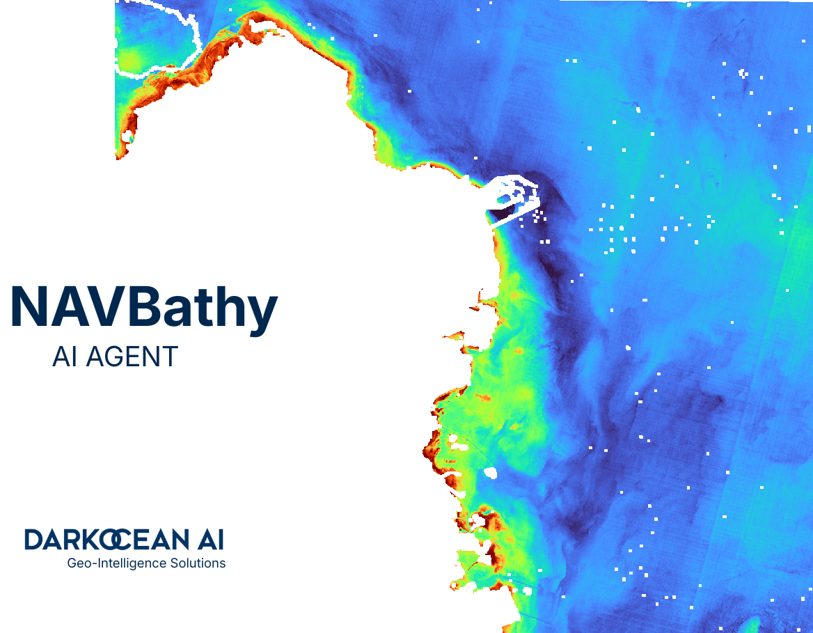
Satellite Derived Bathymetry (SDB)
Generated in Seconds with AI
NAVBathy is the world's fastest satellite derived bathymetry (SDB) platform. Using advanced machine learning and multispectral satellite imagery from Sentinel-2, we generate high-resolution underwater depth maps of coastal and nearshore environments within seconds. Professional optical bathymetry mapping for marine surveys, offshore engineering, and coastal management.
Flexible Credit-Based Access
New users receive 1000 free credits to get started. Subscribe for $20/month to get 2,000 credits monthly, or purchase additional credits as needed. Each bathymetry process costs 50 credits per 10 sq km for scouting and 50 credits per 10 sq km for processing. Download generated TIFF costs 50 credits per sq km. No long-term commitments - cancel subscription anytime.
Scout & Process
50 Credits / 10 km²
+ 50 credits/km² for TIFF download
💡 Subscribe: $20/mo = 2,000 credits
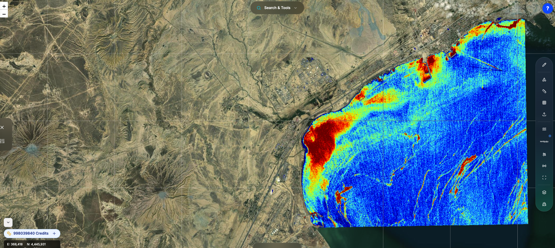
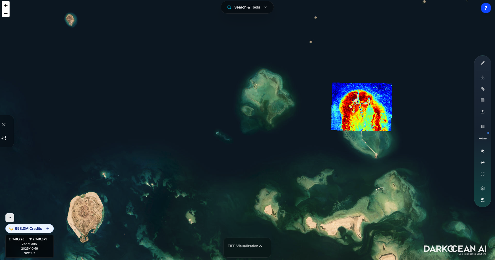
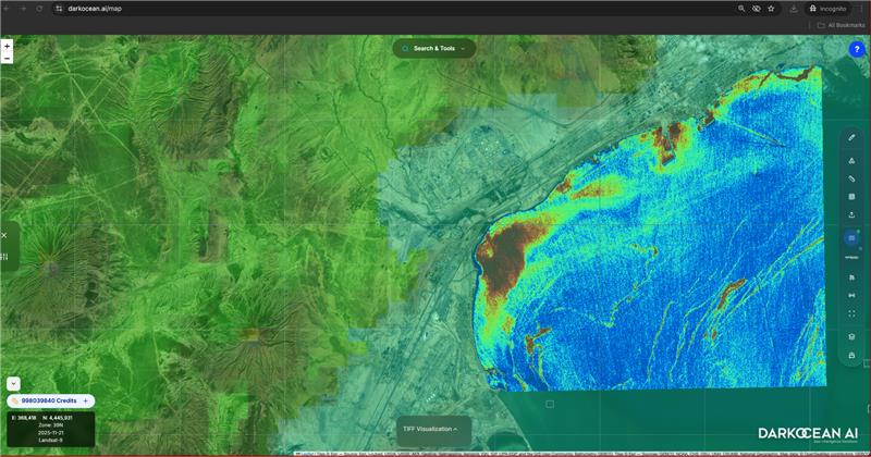
Professional SDB Mapping Results
High-resolution satellite bathymetry maps generated from Sentinel-2 multispectral imagery using our AI-powered optical bathymetry algorithms. Each example demonstrates NAVBathy's capability to produce accurate underwater depth data for coastal mapping and marine surveys.
Why Satellite Derived Bathymetry (SDB)?
Cost-Effective Marine Surveys
Satellite bathymetry mapping costs 90% less than traditional sonar surveys while covering larger areas faster
Rapid Underwater Depth Mapping
Generate satellite derived bathymetry maps in seconds instead of weeks required for traditional surveys
Remote Sensing Bathymetry Access
Map inaccessible or hazardous shallow water areas using optical satellite bathymetry without vessel deployment
Repeatable SDB Monitoring
Track coastal changes and sediment transport over time with consistent satellite bathymetry data
How Satellite Derived Bathymetry (SDB) Technology Works
Our satellite bathymetry software transforms multispectral Sentinel-2 imagery into accurate underwater depth maps using advanced machine learning algorithms and optical remote sensing bathymetry techniques
Multispectral Satellite Data Acquisition
NAVBathy automatically retrieves optimal Sentinel-2 multispectral satellite imagery for satellite derived bathymetry analysis, selecting the best scenes based on cloud coverage, water clarity, and atmospheric conditions to ensure high-quality optical bathymetry results.
Band Ratio & Machine Learning SDB Processing
Advanced satellite bathymetry algorithms analyze visible and near-infrared spectral bands using machine learning models trained on thousands of coastal areas. Our band ratio bathymetry techniques extract accurate depth information while compensating for water column properties and atmospheric effects.
Real-Time Satellite Bathymetry Generation
GPU-accelerated processing delivers professional satellite derived bathymetry maps in seconds. Export results as GeoTIFF for GIS analysis, XYZ point clouds for nautical charting, or 3D meshes for visualization - all industry-standard formats for satellite bathymetry applications.
Satellite Bathymetry Technical Specifications
SDB Coverage Area
100+ km² satellite bathymetry mapping per processing run
Satellite Bathymetry Processing Speed
5-30 seconds for typical coastal SDB surveys
Optical Bathymetry Depth Range
0-15m in clear water (standard satellite derived bathymetry limits for optical sensors)
Satellite Bathymetry Output Formats
GeoTIFF, XYZ, contours, 3D mesh - all standard SDB formats
Sentinel-2 Satellite Bathymetry Resolution
10-20m spatial resolution multispectral SDB mapping
Satellite Bathymetry Accuracy
±0.5-2m vertical accuracy (validated satellite derived bathymetry)
70% Coastal Coverage of Qatar in Under 30 Seconds
In a demonstration of NAVBathy's capabilities, the system processed approximately 70% of Qatar's extensive coastline and over 100 kilometers of adjacent marine areas. This large-scale bathymetric survey was completed in under 30 seconds, showcasing the agent's ability to handle complex coastal geometries and varying water conditions.
Total Area: ~100km of marine coverage spanning Qatar's eastern and northern coastlines
Processing Time: 28 seconds from data acquisition to final bathymetric product
Applications: Offshore infrastructure planning, dredging operations, environmental baseline assessments
High-Resolution Bathymetry for Complex Artificial Structures
NAVBathy excels at mapping bathymetry around intricate artificial islands and coastal developments, providing critical depth information for navigation, maintenance, and environmental monitoring.
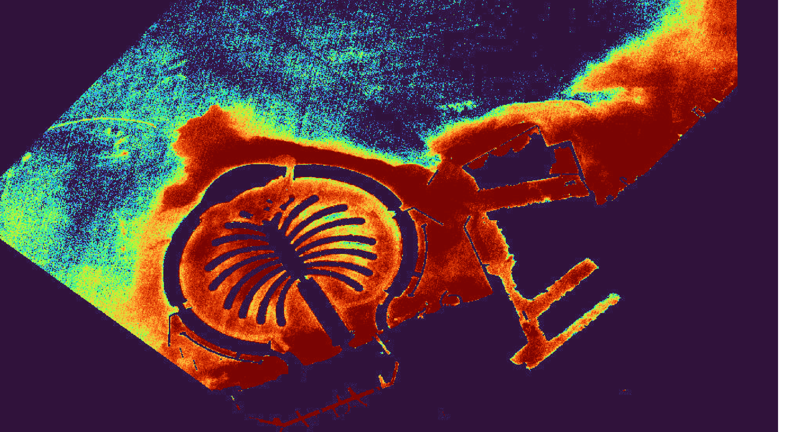
Palm Jumeirah Complex
Complete bathymetric mapping of the iconic Palm Jumeirah, including the palm fronds, crescent, and surrounding navigation channels. The output reveals sediment accumulation patterns and depth variations critical for ongoing maintenance operations.
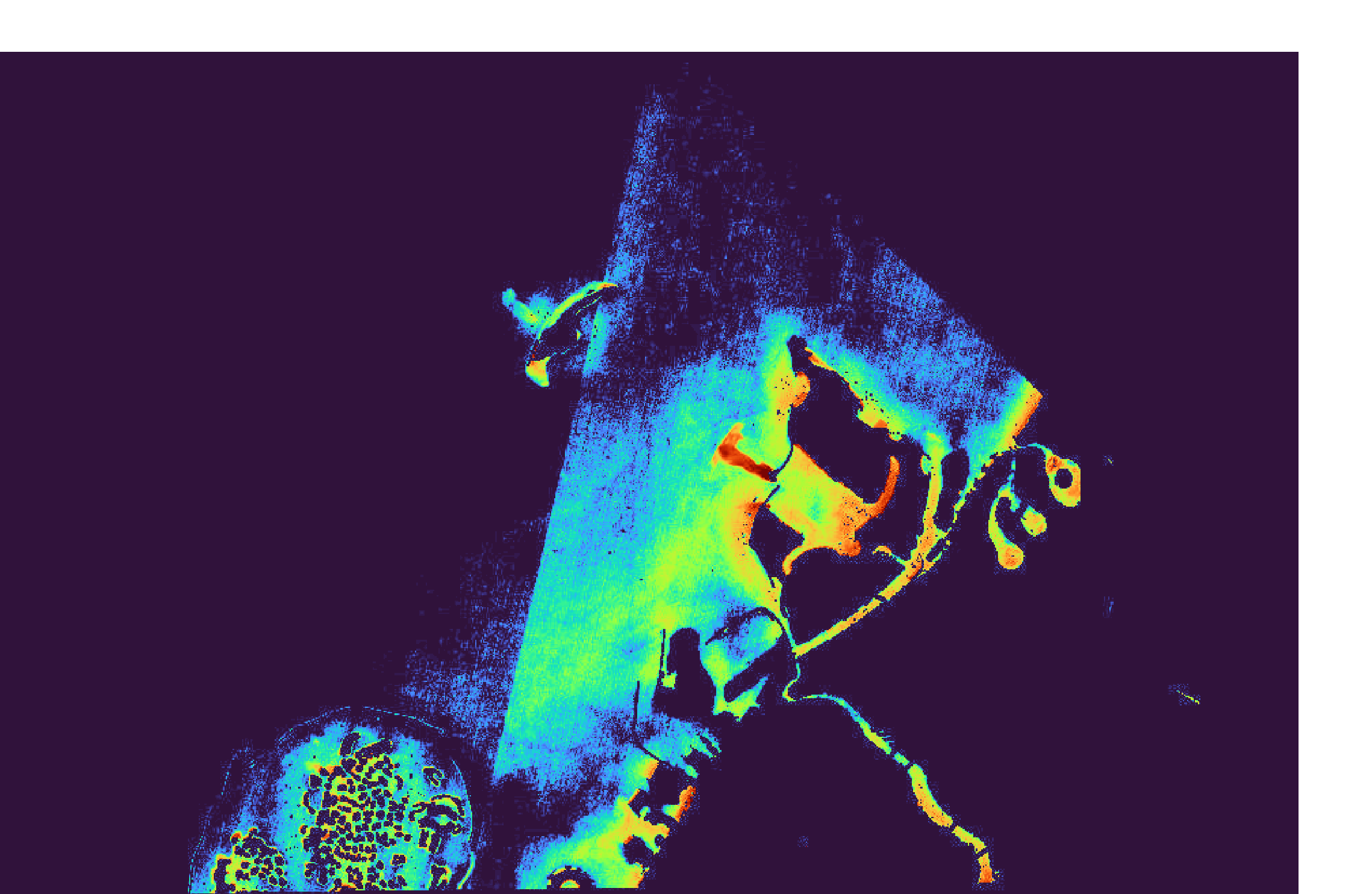
The World Islands
Detailed bathymetric survey of The World Islands archipelago, capturing the complex inter-island channels and surrounding seabed morphology. This data enables precise navigation planning and coastal engineering assessments for future development phases.
Satellite Derived Bathymetry Applications & Use Cases
Professional satellite bathymetry solutions for marine surveys, offshore engineering, coastal management, and nautical charting projects worldwide
Marine Survey & Hydrographic Charting
Satellite bathymetry for nautical charting and marine survey planning. Our SDB software provides rapid baseline data before deploying expensive multibeam sonar vessels, reducing survey costs by up to 90%.
Offshore Engineering & Renewable Energy
Satellite derived bathymetry for offshore platform site selection, wind farm planning, and subsea infrastructure routing. Identify suitable locations and potential hazards before committing to expensive offshore engineering surveys.
Dredging Operations & Harbor Management
Satellite bathymetry solutions for pre-dredge baseline surveys and post-dredge verification. Monitor sediment accumulation patterns with our remote sensing bathymetry technology and plan maintenance schedules efficiently.
Subsea Cable & Pipeline Route Planning
Optical satellite bathymetry for initial route surveys of subsea cables and pipelines. Our SDB mapping identifies depth constraints and optimizes routing to minimize installation costs.
Environmental Monitoring & Coastal Management
Satellite bathymetry for coastal management and environmental impact assessments. Track coastal erosion, sediment transport, and habitat changes over time using repeatable multispectral satellite bathymetry surveys.
Unmanned Surface Vessels (USV) Navigation
Satellite derived bathymetry for autonomous vessel navigation planning. Our SDB software identifies shallow areas and navigation hazards for unmanned vessels operating in remote or poorly charted coastal regions.
Ready to Transform Your Bathymetric Workflow?
Join industry leaders using NAVBathy to accelerate their marine projects with AI-powered bathymetry.